Property Record
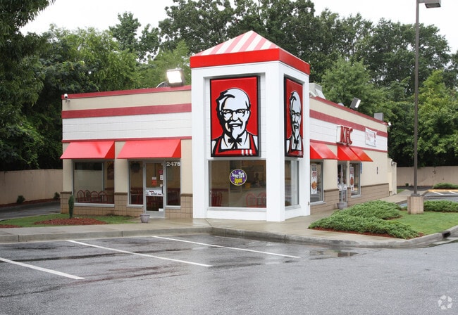
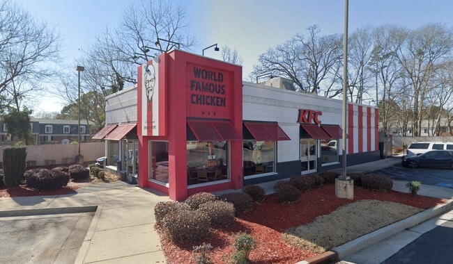
2475 Bouldercrest Rd Se, Atlanta, GA 30316


Property Detail
2475 Bouldercrest Rd Se
15-077-01-010
628 X 80 X 434 X 180 1.6551AC 12-10-97
Restaurantdrivein
DEKALB
C1
Georgia
B and X Area of moderate flood hazard, usually the area between the limits of the 100-year and 500-year floods.
10
2025
1.66 AC
2025
SE Atlanta
023444
Atlanta
2,139 SF
Atlanta-Sandy Springs-Roswell, GA
NEARBY LISTINGS FOR SALE OR LEASE
DEMOGRAPHICS near 2475 Bouldercrest Rd Se
1 mile
3 mile
5 mile
2025 Total Population
4,273
57,449
196,227
2030 Population
4,518
59,016
201,334
Pop Growth 2025-2030
+ 5.73%
+ 2.73%
+ 2.60%
Average Age
40
39
39
2025 Total Households
1,594
21,743
76,085
HH Growth 2025-2030
+ 5.96%
+ 2.64%
+ 2.65%
Median Household Inc
$53,943
$61,433
$73,699
Avg Household Size
2.60
2.50
2.50
2025 Avg HH Vehicles
2.00
2.00
2.00
Median Home Value
$307,593
$290,575
$338,954
Median Year Built
1978
1978
1977
Nearby Places
Map Layers
Map Styles
 Street
 Aerial
Layers
 Traffic
 Biking
Places
Listings with unknown addresses are not visible on the map
- Restaurants
- Banks
- Shops
- Fitness
- Groceries
PUBLIC TRANSPORTATION
AIRPORT
Hartsfield - Jackson Atlanta International
Drive
Walk
Distance
Hartsfield - Jackson Atlanta International
17 min
9.1 mi
SALE & LEASE HISTORY
LISTING DATE
SALE/LEASE

Jun 25, 2024
For Sale
Nearby Properties
Address
Land Use
TOTAL SIZE
Lot Size
Zoning
Address
Land Use
TOTAL SIZE
Lot Size
Zoning
432,056 SF
17.87 AC
C1
Address
Land Use
TOTAL SIZE
Lot Size
Zoning
54 AC
I2
Address
Land Use
TOTAL SIZE
Lot Size
Zoning
105,624 SF
11.62 AC
MR-2
Address
Land Use
TOTAL SIZE
Lot Size
Zoning
381,983 SF
52.54 AC
M
Address
Land Use
TOTAL SIZE
Lot Size
Zoning
210,538 SF
101.40 AC
X
Address
Land Use
TOTAL SIZE
Lot Size
Zoning
278,121 SF
20 AC
RM85
Address
Land Use
TOTAL SIZE
Lot Size
Zoning
72,870 SF
12.34 AC
C2
Address
Land Use
TOTAL SIZE
Lot Size
Zoning
245,053 SF
22.77 AC
RM85
Address
Land Use
TOTAL SIZE
Lot Size
Zoning
295,632 SF
19.26 AC
RM75
Address
Land Use
TOTAL SIZE
Lot Size
Zoning
381,923 SF
19.72 AC
M
Address
Land Use
TOTAL SIZE
Lot Size
Zoning
59,246 SF
3.99 AC
X
Address
Land Use
TOTAL SIZE
Lot Size
Zoning
554,853 SF
42.64 AC
RM75
Address
Land Use
TOTAL SIZE
Lot Size
Zoning
219,652 SF
27.08 AC
C1
Address
Land Use
TOTAL SIZE
Lot Size
Zoning
375,336 SF
22.76 AC
M
Address
Land Use
TOTAL SIZE
Lot Size
Zoning
146,133 SF
16.10 AC
RM75
Address
Land Use
TOTAL SIZE
Lot Size
Zoning
367,452 SF
30.89 AC
RM100
Address
Land Use
TOTAL SIZE
Lot Size
Zoning
59,807 SF
43.70 AC
X
Address
Land Use
TOTAL SIZE
Lot Size
Zoning
150,899 SF
21.89 AC
X
Address
Land Use
TOTAL SIZE
Lot Size
Zoning
207,757 SF
19.22 AC
RM85
Address
Land Use
TOTAL SIZE
Lot Size
Zoning
118,310 SF
10.90 AC
RM85
Address
Land Use
TOTAL SIZE
Lot Size
Zoning
278,272 SF
21 AC
RM100
Address
Land Use
TOTAL SIZE
Lot Size
Zoning
44,365 SF
17.77 AC
M
Address
Land Use
TOTAL SIZE
Lot Size
Zoning
86,071 SF
18 AC
M
Address
Land Use
TOTAL SIZE
Lot Size
Zoning
320,450 SF
38.85 AC
M
Address
Land Use
TOTAL SIZE
Lot Size
Zoning
259,845 SF
17.12 AC
RM85
Address
Land Use
TOTAL SIZE
Lot Size
Zoning
91,446 SF
14.80 AC
RM85
Address
Land Use
TOTAL SIZE
Lot Size
Zoning
13,108 SF
28.02 AC
M
Address
Land Use
TOTAL SIZE
Lot Size
Zoning
129,064 SF
13.29 AC
RM75
Address
Land Use
TOTAL SIZE
Lot Size
Zoning
124,603 SF
10.60 AC
M
Address
Land Use
TOTAL SIZE
Lot Size
Zoning
69,384 SF
29.86 AC
OD
The World's #1 Commercial Real Estate Marketplace
Connect with us
© 2026 CoStar Group
The information above has been obtained from sources believed reliable. While we do not doubt its accuracy we have not verified it and make no guarantee, warranty or representation about it. It is your responsibility to independently confirm its accuracy and completeness. Any projections, opinions, assumptions, or estimates used are for example only and do not represent the current or future performance of the property. The value of this transaction to you depends on tax and other factors which should be evaluated by your tax, financial, and legal advisors. You and your advisors should conduct a careful, independent investigation of the property to determine to your satisfaction the suitability of the property for your needs.